One can debate whether Baron Haussman's razing of old Paris in the 19th century was larger, but certainly the results in the 2 cases were not the same: Bucharest was disfigured.
In 1978, I took a month-long trip to Romania as a single American young man. It was still a time with not very many tourists, and one evening I was sitting alone in a restaurant when two ladies sitting at a nearby table asked if I wanted to join them. It turned out that they were mother and daughter and lived in this corner house, in the second-floor apartment with balcony right above the entrance.
After dinner, I was invited to have a drink at their apartment, and from this window was able to see, unexpectedly, the house where I had lived my entire life in Bucharest, just across the intersection!!

I took this picture of my house the next day; the fresh earthquake damage can be plainly seen. There were barricades which probably condemned the building but they were ignored. Little did I know then that one year later this house as well as the entire neighborhood would be razed, so that most of historic Calea Văcăreşti would no longer exist. In place of my house, the street and much more, there has been a lunar landscape for decades, here's a current satellite image from Google maps.
This blog aims to document some of the architecture of the old Văcăreşti area, mostly with photos already available elsewhere on the web; I thank the providers in advance.
The neighborhood
 |
Calea Văcăreşti runs northward from the River Dimbovita (Splaiul), with Tramway line 1 all along, towards the historic center. My house was just North of the intersection with Marasesti and Str. Olteni. Above, detail from 1939 map; below, map from 1970.  |
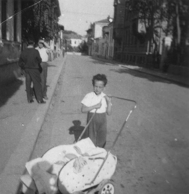
1. Str. Haiducul Bujor can be seen (esp. on 1970 map) spanning between Str. Olteni and Calea Văcăreşti, 3 blocks above Str. Bradului. A 1959 photo shows a child who would have had about my age, on this street. Automobile traffic was not an issue.
2. Just above Str. Bradului, at the tramway station Cauzasi - a little "factory" where I was sent almost daily to fill up a couple of seltzer bottles! The tall building was the bookstore Anton Pann; towards the left are the first houses on str. Legislatorului.

3. Calea Văcăreşti, after the intersection with Str. Bradului (visible on the left) -Dan Vartanian, 1978.

4.Walking down Văcăreşti, we then we reached the intersection with Str. Cantemir, which came from Calea Dudeşti (photo 1976).

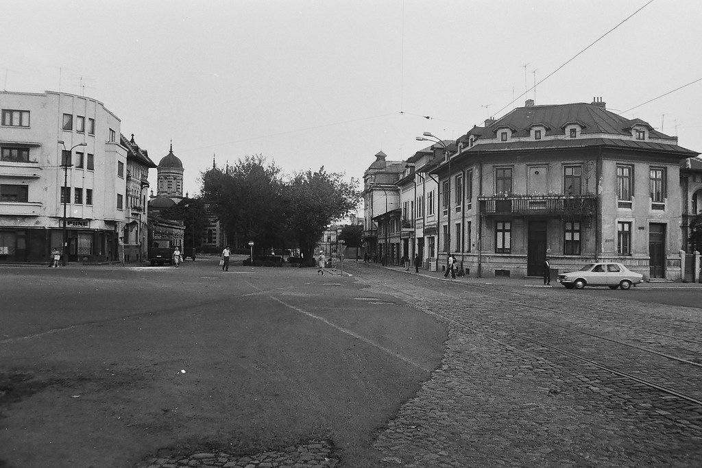
6. Continuing down Calea Văcăreşti (see tramway tracks), we reach the intersection with Bd. Mărăşeşti (right) and strada Florilor (left). This place was known as Piaţa Mărăşeşti. The building at the corner behind the Dacia was discussed previously - a little further down is the barber who cut my hair. Further down on the left can be seen the bell tower of the church in Photo 10 below.

7. Turning around to see in the reverse direction, here Blvd. Mărăşeşti appears on the left (again, the corner building with the balcony from previous photo). The building on the right was right across the street from my house.


9. Adjacent to previous photo, towards the Splai, there is an enlarged portion of Calea Văcăreşti which included a square with vegetation. Neighborhood children gathered to play football in this segment, between Str. Florilor and Dr. Anghel, where rarely a car passed.

10. On the opposite side of Calea Văcăreşti right about facing the streets mentioned in previous 2 pictures, are Dobroteasa church, built in 1884, in the Byzantine style, with a height of 28 meters. Between 1983-1989 it was closed for demolition, but luckily it escaped.

And here it is, in 2018, with a few more cars.
11. A couple of other pictures taken in the summer of 1978 in the neighborhood; unfortunately I can't place them geographically.

11. A couple of other pictures taken in the summer of 1978 in the neighborhood; unfortunately I can't place them geographically.


Photo #10: right in front of the church is where we played football, 8 days a week! That was in the mid to late 50's.
ReplyDeleteI lived pe Strada Olteni nr 76 ..used to ride my bike around Biserica Dobroteasa..(left Bucharest in 1965) Any idea how to connect with the blogger who posted these pictures..we might even be related. My contact info: anilie53@gmail.com
Delete